www.EdonEverest.com
Date: Spring Climbing Season 2010 (March to June)
Route: Tibet
Company: Himalayan Ecstasy
In Aid of: Himalayan Rescue Association/Everest E.R.
Expedition Leader: Ed Laughton
Lead Climber: Roshan (Dipin) Bhattarai
Expedition Manager: Sujan Bhattarai
The 'Ed on Everest' Expedition will attempt to summit the highest mountain on earth via the Northern Tibetan route in the Spring of 2010. The purpose of the expedition is to raise funds for Himalayan Rescue Association and Everest E.R. and to raise awareness of the life saving work that these charities undertake.
My own plan for the expedition is to fly back out to Kathmandu, the capital of Nepal, on the 7th of March 2010. Anil, Dipin, Sujan and I will then spend a couple of days doing an initial gear/equipment check through and start to sort out the paperwork necessary for entering the Tibetan Autonomous Region of China. My 'Dhai' Dipin (Dhai is a respectful term meaning older brother), the lead climber of the expedition and multiple Everest summiteer, and I will then travel to the east of the country where the Bhattarai boys of Himalayan Ecstasy originate from. There we will do some acclimatisation climbs in the shadow of Kangchenjunga (the world's 3rd highest mountain) and hopefully pop in to see Dipin's Mum for a cup of chai.
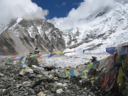
Then its back to Kathmandu for a last sort through and any further administration/visa problem solving. Sometime in late March the expedition then sets off for an arduous six day drive into Tibet, crossing over the infamous Friendship Bridge in the process. Early April will see us settle in at Basecamp on the Rongbuk Glacier (5180m) in Tibet and begin the long, tiring and arduous process of acclimatising.
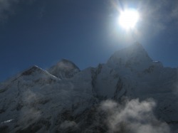
The route we shall be taking is the Northeast Ridge. In order to reach Camp 2 from base camp we will climb the medial moraine of the east Rongbuk Glacier up to the base of a neighbouring peak called Changtse, with the camp located at approximately 6100m. Camp 3 is often referred to as Advanced Base Camp and is situated on the North Col at 6500m. To reach Camp 4 on the north col, the route ascends the glacier to the foot of the col where fortunately fixed ropes are used to reach the North Col itself which stands at 7010m. The route then ascends the usually rocky northern ridge to Camp 5 (7775m). Climbers then cross the 'North Face' diagonally to the Yellow Band and after crossing this distinctive obstacle will reach Camp 6 at 8230m.
It's from here that we hope to make our final summit push, climbing up through the night and hoping to arrive around mid-morning the following day. From Camp 4 there is a treacherous traverse from the base of the First Step to the crux of the climb, the challenging Second Step, which includes the infamous "Chinese ladder", a metal ladder placed in 1975 by Chinese climbers that has been used ever since. The next obstacle is the relatively small Third Step, though at this altitude nothing is easy or straight forward. Climbers then face a long snow slope of about 50 degrees to the summit pyramid and the final summit ridge along which the highest point on earth is reached.
Its too early to predict a possible summit attempt date now, but the right weather conditions and the lifting of the Jet Stream from the summit normally occur early to mid May - I'll keep you posted on the blog as dates become more certain.